Implementing Web GIS Solutions with Open Source Software: Overview and Frameworks

This talk provides an overview of open source web GIS solutions and frameworks, including components of a web GIS and available tools such as OGR, GDAL, GeoServer, Mapbender, and Leaflet. It also explores how to extend GIS capabilities and build your own application in just five simple steps.
- Uploaded on | 0 Views
-
 winonafay
About Implementing Web GIS Solutions with Open Source Software: Overview and Frameworks
PowerPoint presentation about 'Implementing Web GIS Solutions with Open Source Software: Overview and Frameworks'. This presentation describes the topic on This talk provides an overview of open source web GIS solutions and frameworks, including components of a web GIS and available tools such as OGR, GDAL, GeoServer, Mapbender, and Leaflet. It also explores how to extend GIS capabilities and build your own application in just five simple steps.. The key topics included in this slideshow are open source, web GIS, components, frameworks, tools,. Download this presentation absolutely free.
Presentation Transcript
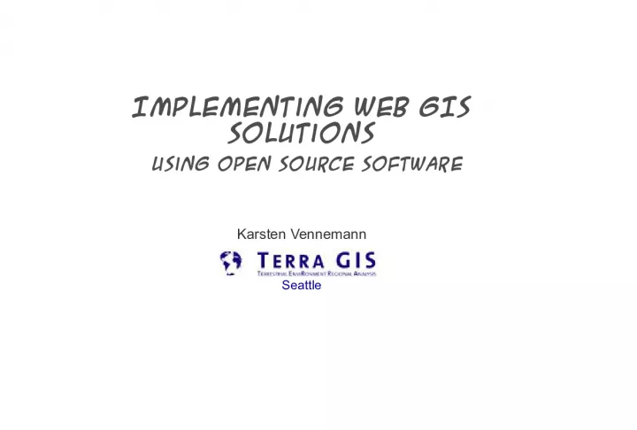
1. Implementing Web GIS Solutions using open source software Karsten Vennemann Seattle
2. Open Source Web GIS Solutions Talk Overview Why and What What is Open Source (GIS)? Why use it ? Overview of Web GIS Components of a Web GIS What is out there ? Some Foundations OGR, GDAL, PROJ4, GeoTools Web GIS Engines MapServer GeoServer Frameworks Mapbender, MapFish, Cartaro Open Layers 2 + 3, Leaflet, D3, CesiumJS Extending GIS Capabilities Spatial Data Storage Solutions Additional Tools Resources How can you build your own ? 5 simple steps Application Components Talk Overview
3. Open Source Web GIS Solutions What is Open Source (GIS)? Why and What While most open source geospatial software is built on the standards of the Open Geospatial Consortium (OGC) the term Open Source it is not synonymous with Open Standards because both proprietary and open source software can be compliant with the OGC Open Standards. http://www.opengeospatial.org OSGeo is the organization that supports the development of the highest quality open source geospatial software. http://www.osgeo.org Open source means that the source code is available to the general public for use, distribution, and modification from its original design free of charge (among a long list of other requirements) Open Source Open Standards
4. Open Source Web GIS Solutions Why use it ? General and incomplete listing Why and What It is free User is in control Pick you favorite operating system: supports many operating systems: Windows-Linux-Solaris- No licensing issues (did we install one to many PCs with software XY?) Vendor independency Access to source code: dont like something, need changes to the core system, need extensions hire somebody to change it right now High performance, high quality, high interoperability distributed programming effort, highly modular System heterogeneity - less prone to hacker attacks and viruses Interoperable very advanced support of OGC open standards Exceptional Support - Commercial and non commercial Mailing lists, user groups, Conferences, IRC channels Fast response times for bug fixes typically tracked on the web accessible and open to everybody to report or fix a bug
5. Open Source Web GIS Solutions What is out there ? Overview of Web GIS A whole lot ! More than 250 project entries on http://opensourcegis.org/ Selection of some of the most advanced and popular Web GIS components
6. Open Source Web GIS Solutions Web browser Mapping Engine Server Side Framework Overview of Web GIS Schematic View Interoperable Web GIS Web Server Spatial Data Vector file Raster file Spatial DB Server computer(s) Client Side Scripting (JavaScript/AJAX) WMS/ WFS Mapping Engine Mapping Engine Client Side Framework Client computer Additional Services Data Access (Read/Write) Caching and Tiling Extended GIS Functionality Web Processing Services
7. Open Source Web GIS Solutions Modified from The State of Open Source GIS, Paul Ramsey, Sep. 2007, formerly Refractions Research, Victoria, BC, Canada TileCache WMS MapServer FeatureServer GeoServer MapBender Cartaro OpenLayers Leaflet MapFish Overview of Web GIS Relations of Web GIS Components File Sources PostGIS
8. Open Source Web GIS Solutions A few libraries that are the foundation of many Open Source and commercial Geospatial Software Packages GDAL (Raster) and OGR (Vector) Geospatial Data Abstraction Library / OpenGIS Simple Features Reference Implementation Tools for reading, writing and processing of raster and vector data sets -> formats Important base for many Desktop GIS systems e.g. ArcGIS OGR extends Mapserver formats Oracle Spatial, ESRI Geodatabase (MDB), TIGER, MapInfo PROJ4 is a library for cartographic projection routines stand alone projection utility proj libraries for more than 2500 projections (e.g. EPSG list) GeoTools is an open source Java GIS toolkit is a library for cartographic projection routines Similar usage as OGR and GDAL for Java based projects Udig and GeoServer are based on GeoTools Some Foundations Some Foundations (Tools)
9. Open Source Web GIS Solutions OpenLayers JavaScript API Leaflet JavaScript API D3 JavaScript API Cesium Client Side JavaScript/Ajax Libraries Frameworks Web GIS Frameworks Client-Server Side JavaScript/Ajax Libraries Server Side Scripts, Database Mapbender 2.X + 3 PHP, JavaScript, PostGIS MapFish Python (Pylons), Java Script (ExtJS) and OpenLayers Cartaro PHP, JavaScript Drupal CMS
10. Open Source Web GIS Solutions Object-oriented JavaScript library version 2+ 3 OL 2.X using Prototype.js and Rico library) OL 3 using Googles Closure Tools (compiler+ library) Lets you add maps to any web page by embedding OpenLayer.js no server-side dependencies Easily reusable component similar to Google Maps and BING Web Mapping APIs Input Formats Bing, Open Street map, Google Maps, WMS, Vector layers, GeoRSS, WFS, KML Standard Tools Google Like zoom bar, standard functions like zoom in/out pan Client side - Frameworks Open Layers
11. Open Source Web GIS Solutions Web GIS Engines D3.js D3.js is a JavaScript library for manipulating documents based on data supports many kinds of visualizations (e.g. charts) based on a combination of HTML, SVG and CSS Mapping capabilities interesting alternative in browser visualization of geographic and non geographic objects. TopoJSON format is an extension of GeoJSON topology - eliminating redundancy in data D3 and Leaflet can be combined (TopoJSON is available in Leaflet via D3) Mike Bostock examples Globe projections transitions example
12. Open Source Web GIS Solutions Web GIS Engines a lightweight JS Library about 33KB size works efficiently on desktop + mobile platforms many functions but lacking the more advanced GIS features OpenLayers 2.X + OL 3 caters to. good choice if (download) speed is the main objective, compatibility with mobile devices is important and if more advanced GIS features are not needed Can be extended with large collection number of plugins
13. Open Source Web GIS Solutions Web GIS Engines Cesiumjs Cesium is a JS library enabling 2D maps +3D Globe visualizations , using WebGL , Apache 2 lic
14. Open Source Web GIS Solutions Web GIS Engines Cesiumjs Jotunheimen Norway - rendered with 10 m elevation data from the Norwegian Mapping Authority Credit Bjrn Sandvik
15. Open Source Web GIS Solutions MapServer (C) GeoServer (Java) Mapnik (C++) Map Guide Open Source (C++) + Fusion by DM Solutions Web GIS Engines Web GIS Engines
16. Open Source Web GIS Solutions Originally developed at the University of Minnesota (UMN), short MapServer one of the most mature open source projects written in C Main Focus rendering spatial data development environment for spatially-enabled internet applications Map output CGI mapserv (Linux) and mapserv.exe (windows) MapScript API available for Python, PHP, Perl, and Java Map/Layer configuration text file .map Formats In: PostGIS, Oracle Spatial ArcSDE, WMS, GDAL and OGR formats Out: GIF, JPG, PNG, all GDAL formats, WFS and WMS Web GIS Engines
17. Open Source Web GIS Solutions Web GIS Engines Main supporter The Open Planning Project (TOPP) newer development than Mapserver) written in Java, built on top of Geotools (like Udig) Main Focus rendering images, serving and editing spatial data More differences to Mapserver configuration web-based Graphical user interface (stored as xml) transactional capabilities, support for shared editing Formats PostGIS, Shapefile, ArcSDE, DB2, Oracle (soon VPF, MySQL, MapInfo, WFS) JPG, GIF, PNG, SVG, KML/KMZ, GML, Shapefile, GeoJSON, GeoRSS WFS , WMS and KML output
18. Open Source Web GIS Solutions Web GIS Engines
19. Open Source Web GIS Solutions Main supporter Camptocamp Widgets and plugins oriented architecture MapFish Client - JavaScript framework two parts mapping part OpenLayers user interface (GUI widgets) ExtJs + GeoExt library MapFish Server MapFish Server is a Python framework (based on Pylons) Main Focus - Adding server side framework to OpenLayers Advanced UI components: layer tree Server-side services: authentication, query Server-side processing: routing, editing Print Module (Java based and independent) Client/Server - Frameworks MapFish
20. Open Source Web GIS Solutions Map Fish demo Client/Server - Frameworks MapFish
21. Open Source Web GIS Solutions Mapbender Client/Server - Frameworks Main supporter WhereGroup Comprehensive Client - Server framework implemented in PHP, JavaScript and XML Management Database MySQL or PostgreSQL Functionality displaying, navigating, editing and querying spatial data and maps map services authorization services (OWS proxy functionality) management interfaces for user, group and service administration Management of WMS and WFS User interface configuration and tool stored in data base Input WMS and WFS
22. Open Source Web GIS Solutions Extending GIS Capabilities PostGIS Spatial Database PostGIS is an extension for PostgreSQL adds support for geographic objects to PostgreSQL enables PostgreSQL server to be used as a backend spatial database for GIS Spatial operations and analysis simply mean running a (spatial) SQL query in the database Similar functions as SDE and much more . PostGIS
23. Open Source Web GIS Solutions pgAdmin GUI base Database administration tool PostGIS
24. Open Source Web GIS Solutions PostGIS tables geometry columns spatial reference table PostGIS
25. Open Source Web GIS Solutions PostGIS Functions Spatial SQL PostGIS
26. Open Source Web GIS Solutions FeatureServer middleware for publishing and modifying geospatial data in lots of different formats to the web (RESTful Geographic Feature Service) dynamic capabilities to read geographic features (or collections) with standard HTTP methods from distributed sources (aggregation) translate geographic features between formats e.g. input shape file and open in Google Earth TileCache server software solution with caching and rendering capabilities create your own local disk-based cache of any WMS server use the resulting map tiles in supporting clients e.g. OpenLayers, Google maps, Virtual Earth, Worldkit create a fast performing slippy style map a la Google Maps Extending GIS Capabilities Extending GIS Capabilities - Additional tools
27. Open Source Web GIS Solutions Extending GIS Capabilities Map Tile Caching Server / engines TileCache www.tilecache.org TileStache http://tilestache.org/ GeoWebCache http://geowebcache.org MapProxy tiles, server proxy, security http://mapproxy.org MapCache www.mapserver.org TileMill map styling - http://mapbox.com/tilemill
28. Open Source Web GIS Solutions But you still have one important question ! How can I build my own WEB GIS ? Resources in 5 simple steps
29. Open Source Web GIS Solutions Resources Articles The State of Open Source GIS , Version September 2007. By Paul Ramsey, formerly Refractions Research, Victoria. 49pages Web Sites Free GIS Project http://www.freegis.org/ Open source GIS list http://opensourcegis.org/ Map Tools http://maptools.org/ OSGeo http://www.osgeo.org/
30. Open Source Web GIS Solutions Simple Feature Library (OGR) www.gdal.org Geospatial Data Abstraction Library (GDAL) www.gdal.org GeoTools http://www.geotools.org PROJ4 http://trac.osgeo.org/proj MapServer http://mapserver.org GeoServer http://geoserver.org Mapnik http://mapnik.org OpenLayers www.openlayers.org Leaflet http://leafletjs.com Mapbender www.mapbender.org MapFish http://mapfish.org Cartaro http://cartaro.org Map Guide Open Source https://mapguide.osgeo.org PostgreSQL www.postgresql.org PostGIS http://postgis.refractions.net Django https://www.djangoproject.com TileCache www.tilecache.org Resources Open source utilities and websites
31. Open Source Web GIS Solutions Local GIS user group: Cascadia Users of Geospatial Open Source www.cugos.org http://groups.google.com/group/cugos Monthly meeting every 3rd Wednesday, 5:30 pm Resources