Exploring the Changing Altitude of Polaris

In this virtual field trip, we will take a journey to different spots on Earth and observe the stars there. Our focus will be on two major constellations and one very important
- Uploaded on | 4 Views
-
 floydcarr
About Exploring the Changing Altitude of Polaris
PowerPoint presentation about 'Exploring the Changing Altitude of Polaris'. This presentation describes the topic on In this virtual field trip, we will take a journey to different spots on Earth and observe the stars there. Our focus will be on two major constellations and one very important. The key topics included in this slideshow are . Download this presentation absolutely free.
Presentation Transcript
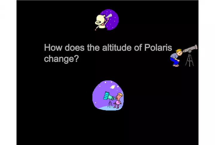
Slide1 How does the altitude of Polaris change?
Slide2We w i l l b e t a k i n g a “ v i r t u a l ” f i e l d t r i p t o d i f f e r e n t s p o t s o n t h e E a r t h a n d v i e w i n g t h e s t a r s t h e r e . W e a r e g o i n g t o f o c u s i n o n t w o m a j o r c o n s t e l l a t i o n s , a n d o n e v e r y i m p o r t a n t s t a r — P o l a r i s , o r t h e N o r t h S t a r .
Slide3Altitude: the angle of a celestial object above the horizon Constellation : group of stars that form a pattern and are used to help people locate celestial objects Latuitude : angular distance north or south of the equator
Slide4Th r o u g h t h e m a g i c o f “ v i r t u a l a s t r o - v i s i o n , ” w e w i l l b e v i e w i n g t h e s k y a t t h e s a m e t i m e i n e v e r y l o c a t i o n w e g o t o ! W e n e e d t o d o t h i s s o t h a t w e c a n s e e t h e s k y t h e s a m e w a y a t e a c h l o c a t i o n .
Slide5As y o u m a y a l r e a d y k n o w , o u r v i e w o f t h e c o n s t e l l a t i o n s c h a n g e o v e r a n e v e n i n g — t h e s t a r s a p p e a r t o m o v e b e c a u s e t h e E a r t h i s r o t a t i n g ! * * * * Y o u r v i e w o f t h e s k y a t 9 : 0 0 p . m . i s d i f f e r e n t f r o m y o u r v i e w a t 1 1 : 0 0 p . m . , j u s t f o r e x a m p l e . ****Polaris is the exception to this!!!
Slide6We are going to deal with thisproblem by arriving at each location at precisely the same time…through our superstellar supersonic time machine (SSTM)!
Slide7Hop on board!
Slide8Our first stop is really close by!Central Park in New York City!
Slide10New York, New York 41o N Latitude Big Dipper Cassiopeia Polaris Pointer Stars
Slide11We are going to “calibrate” our screen sothat we can make measurements of the location of Polaris in other places on Earth. ALTITUDE We will be using a device called a “sextant.” This measures the star’s angle above the horizon. This is called ALTITUDE . This simulation is only in 2-D, so the sextant appears like a ruler. However, in the real-world of 3-D, this device would measure what angle you have to tilt your head up in order to see a star. Therefore, if the star is at the horizon, the angle is ZERO. Directly overhead, the angle is 90 o .
Slide12New York, New York 41o N Big Dipper Cassiopeia Polaris Pointer Stars Measure the altitude of Polaris 10 20 30 40 50 60 70 0
Slide13NS W E 41 o P O L A R I S H O R I Z O N There is a 41 degree angle between the horizon and Polaris. In other words, the viewer must tilt his or her head (and telescope!) up 41 o from the horizontal in order to directly see Polaris. What does this view “feel like” in 3-dimensions? The arc represents the Celestial hemisphere (the sky above) The ground
Slide14What is thelatitude of NY city?
Slide15Now let’s head to Tampa, Florida andview the night sky there!
Slide17Tampa, FloridaWhat is the altitude of Polaris in Tampa? (Use the pointer stars of the Big Dipper) 0 10 20 30 40 50 60 70
Slide18What is the altitude of Polaris in Tampa?Again, let’s draw it in 3-D on the celestial sphere diagram!
Slide19NS W E HORIZON What does this view “feel like” in 3-dimensions? The arc represents the Celestial hemisphere (the sky above) The ground In Tampa, would you tilt your head up more or less than in New York in order to see Polaris? Plot the position of Polaris for Tampa
Slide20Tampa, Florida0 10 20 30 40 50 60 70 Did you notice that the Big Dipper, and Cassiopeia are also lower in the sky here…
Slide21New York, New York 41o N 10 20 30 40 50 60 70 0 …than in New York!
Slide22What is thelatitude of Tampa?
Slide23Now we are flying off toPopayán, Colombia in order to view the tropical night sky!
Slide25Popayán , Colombia What is the altitude of Polaris in Popay án ? 0 10 20 30 40 50 60 70
Slide26What is the altitude of Polaris in Popayán ? Again, let’s get a feeling of what this looks like in 3-D!
Slide27NS W E HORIZON What does this view “feel like” in 3-dimensions? The arc represents the Celestial hemisphere (the sky above) The ground In Popayán, how would you have to orient your head so you could see Polaris? Plot the position of Polaris for Popayán
Slide28What is thelatitude of Popayán?
Slide29Predict where you wouldfind Polaris if you were at the Equator (O o )
Slide30Let’s see if you are getting the hang of this! For our next stop we are going to view the sky FIRST, and then predict our latitude from our view of Polaris! P r e t t y n e a t , h u h !
Slide31Mystery Location
Slide32Before, we measure,determine this: Are we North or South of NY? Here is NY again for comparison…
Slide33New York, New York 41o N Latitude And now back to our mystery location!
Slide34010 20 30 40 50 60 70 O.K.! Let’s determine the altitude of Polaris…
Slide35NS W E HORIZON So where is Polaris in this location? The arc represents the Celestial hemisphere (the sky above) The ground So now we know what latitude we are at. What is it?
Slide36Of thechoices given, where in the world are we? New Orleans, LA Washington, D.C. Hartford, CT Quebec City, Canada Churchill, Canada
Slide37Now that you’re so good at this,predict the altitude of Polaris at the North Pole!
Slide38Let’s imagine what it would be liketo do this at the North Pole. Be careful you don’t strain your neck! … a n d m a k e s u r e y o u a r e E X T R A g o o d w h i l e y o u a r e h e r e ! ! ! ! Y o u k n o w w h o ’ s w a t c h i n g … .
Slide417080 60 50 40 30 20 10
Slide427060 50 80 40 30 20
Slide439080 70 60 50 40
Slide449080 70 60
Slide459080 70 60 What is the altitude of Polaris?
Slide46NS W E HORIZON Where is Polaris at the North Pole? The arc represents the Celestial hemisphere (the sky above) The ground Describe what you would have to do in order to view Polaris at the North Pole.
Slide47All aboard for our last stop!Another mystery location for you to solve!
Slide53to give you a hint, we’ll place a marker where polaris would beif we were in New York at this time… Do the measurement…
Slide54010 20 30 40 50 60
Slide55Of thechoices given, where in the world are we? Meridian, MS Havana, Cuba Philadelphia, PA Ottawa, Canada Churchill, Canada
Slide56We l l , o u r a d v e n t u r i n g i s o v e r f o r t o d a y ! T h a n k s f o r m a k i n g o u r m i s s i o n a s u c c e s s !
Slide57well, our adventuring is over for today! thanks formaking our mission a success!
Slide58well, our adventuring is over for today! thanks formaking our mission a success!
Slide59well, our adventuring is over for today! thanks formaking our mission a success!
Slide60well, our adventuring is over for today! thanks formaking our mission a success!
Slide61well, our adventuring is over for today! thanks formaking our mission a success! WHEE! See you next time!!!!!