Introduction to GPS and Land Surveying

This presentation covers the basics of GPS and land surveying, including coordinate systems, surveying tools, and field exercises. It also explains the classical definition of land surveying and the legal statutes surrounding it.
- Uploaded on | 0 Views
-
 gitaharris
About Introduction to GPS and Land Surveying
PowerPoint presentation about 'Introduction to GPS and Land Surveying'. This presentation describes the topic on This presentation covers the basics of GPS and land surveying, including coordinate systems, surveying tools, and field exercises. It also explains the classical definition of land surveying and the legal statutes surrounding it.. The key topics included in this slideshow are GPS, coordinate systems, land surveying, survey tools, legal statutes,. Download this presentation absolutely free.
Presentation Transcript
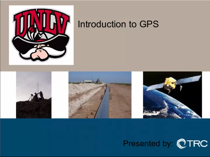
1. Introduction to GPS Presented by:
2. WELCOME Introductions Scott Hill PLS, PMP Expectations What is Land Surveying? Class Material to be Covered Coordinate Systems GPS Principles GPS Surveying Survey Tools Field Exercise Classroom Exercise 2
3. What is Land Surveying, and a Land Surveyor? Classical Definition The use of the principles of mathematics to establish the location of Real Property Boundaries or points on the ground. Usually defined by statute. Nevada NRS 625.040 - NRS 625.070 Arizona ARS 32-101.22 - ARS 32-101.23 California California Business and Professional Code Section 8726-8731
4. 4 Coordinate Systems Assumed Coordinate Systems Map Projections Geodetic Datums Global Coordinate Systems UTM Universal Transverse Mercator ECEF Earth Fixed, Earth Centered NAD 83 SPC State Plane Coordinates HARN CORS
5. Coordinate Systems Assumed Coordinate Systems Cartesian Coordinates based on x,y,z axis Northing (y), Easting (x), Elevation (z) 5
6. Coordinate Systems Map Projections 6
7. Coordinate Systems-Projections Mercator The Mercator projection has straight meridians and parallels that intersect at right angles. Scale is true at the equator or at two standard parallels equidistant from the equator. The projection is often used for marine navigation because all straight lines on the map are lines of constant azimuth. 7 Transverse Mercator Transverse Mercator projections result from projecting the sphere onto a cylinder tangent to a central meridian. Transverse Mercator maps are often used to portray areas with larger north-south than east-west extent. Distortion of scale, distance, direction and area increase away from the central meridian. Used by USGS for many quadrangle maps at scales from 1:24,000 to 1:250,000; such maps can be joined at their edges only if they are in the same zone with one central meridian.
8. Coordinate Systems-Projections 8 Lambert Conformal Conic Used by USGS for many 7.5- and 15-minute topographic maps and for the State Base Map series. Also used to show a country or region that is mainly east-west in extent. One of the most widely used map projections in the United States today. Distances true only along standard parallels; reasonably accurate elsewhere in limited regions. Directions reasonably accurate. Distortion of shapes and areas minimal at, but increases away from standard parallels. Shapes on large-scale maps of small areas essentially true. Robinson Uses tabular coordinates rather than mathematical formulas to make the world "look right." Better balance of size and shape of high-latitude lands than in Mercator. Directions true along all parallels and along central meridian. Distances constant along Equator and other parallels, but scales vary. All points have some distortion. Very low along Equator and within 45 of center. Greatest near the poles. Used in Goode's Atlas, adopted for National Geographic's world maps in 1988, appears in growing number of other publications, may replace Mercator in many classrooms.
9. Coordinate Systems Geodetic Datums Geodetic datums define the reference systems that describe the size and shape of the earth. Hundreds of different datums have been used to frame position descriptions since the first estimates of the earth's size were made by Aristotle. Datums have evolved from those describing a spherical earth to ellipsoidal models derived from years of satellite measurements. Modern geodetic datums range from flat-earth models used for plane surveying to complex models used for international applications which completely describe the size, shape, orientation, gravity field, and angular velocity of the earth. While cartography, surveying, navigation, and astronomy all make use of geodetic datums, the science of geodesy is the central discipline for the topic. Referencing geodetic coordinates to the wrong datum can result in position errors of hundreds of meters. Different nations and agencies use different datums as the basis for coordinate systems used to identify positions in geographic information systems, precise positioning systems, and navigation systems. The diversity of datums in use today and the technological advancements that have made possible global positioning measurements with sub-meter accuracies requires careful datum selection and careful conversion between coordinates in different datums.
10. 10 Coordinate Systems Geodetic Datums Global Coordinate System UTM Earth Fixed, Earth Centered State Plane Coordinate System HARN CORS
11. Coordinate Systems Global Coordinate Systems The most commonly used coordinate system today is the latitude, longitude, and height system. The Prime Meridian and the Equator are the reference planes used to define latitude and longitude. The geodetic latitude (there are many other defined latitudes) of a point is the angle from the equatorial plane to the vertical direction of a line normal to the reference ellipsoid. The geodetic longitude of a point is the angle between a reference plane and a plane passing through the point, both planes being perpendicular to the equatorial plane. The geodetic height at a point is the distance from the reference ellipsoid to the point in a direction normal to the ellipsoid.
12. Coordinate Systems UTM Coordinates - Universal Transverse Mercator 12
13. Coordinate Systems UTM Universal Traverse Mercator Coordinate System The UTM system was an attempt to set up a universal world wide system for mapping. The Transverse Mercator projection is used, with the cylinder in 60 positions. This creates 60 zones around the world. Positions are measured using Eastings and Northings, measured in meters, instead of Latitude and Longitude. Eastings start at 500,000 on the centre line of each zone. In the Northern Hemisphere, Northings are zero at the equator and increase northward. In the Southern Hemisphere, Northings start at 10 million at the equator, and decrease southward. You must know which hemisphere and zone you are in to interpret your location globally. Distortion of scale, distance, direction and area increase away from the central meridian. Put another way: UTM projection is used to define horizontal positions world-wide by dividing the surface of the Earth into 6 degree zones, each mapped by the Transverse Mercator projection with a central meridian in the center of the zone. UTM zone numbers designate 6 degree longitudinal strips extending from 80 degrees South latitude to 84 degrees North latitude. UTM zone characters designate 8 degree zones extending north and south from the equator. Eastings are measured from the central meridian (with a 500 km false easting to insure positive coordinates). Northings are measured from the equator (with a 10,000 km false northing for positions south of the equator). UTM is applied separately to the Northern and Southern Hemisphere, thus within a single UTM zone, a single X / Y pair of values will occur in both the Northern and Southern Hemisphere. To eliminate this confusion, and to speed location of points, a UTM zone is sometimes subdivided into 20 zones of Latitude. These grids can be further subdivided into 100,000 meter grid squares with double-letter designations. This subdivision by Latitude and further division into grid squares is generally referred to as the Military Grid Reference System (MGRS). The unit of measurement of UTM is always meters. The zones are numbered from 1 to 60 eastward, beginning at the 180th meridian. Some software uses negative zone numbers to indicate that the data is in the southern hemisphere, e.g. zone 19 is north of the equator, zone -19 is south of the equator .
14. Coordinate Systems Earth Centered, Earth Fixed (ECEF) Coordinates Earth Centered, Earth Fixed Cartesian coordinates are also used to define three dimensional positions. Earth centered, earth-fixed, X, Y, and Z, Cartesian coordinates (XYZ) define three dimensional positions with respect to the center of mass of the reference ellipsoid. The Z-axis points toward the North Pole. The X-axis is defined by the intersection of the plane define by the prime meridian and the equatorial plane. The Y-axis completes a right handed orthogonal system by a plane 90 degrees east of the X-axis and its intersection with the equator.
15. Coordinate Systems NAD 83 Official datum used for the primary geodetic network in North America. 15
16. Coordinate Systems State Plane Coordinates In the United States, the State Plane System was developed in the 1930s and was based on the North American Datum 1927 (NAD27). NAD 27 coordinates are based on the foot. While the NAD-27 State Plane System has been superseded by the NAD-83 System, maps in NAD-27 coordinates (in feet) are still in use. Most USGS 7.5 Minute Quadrangles use several coordinate system grids including latitude and longitude, UTM kilometer tic marks, and applicable State Plane coordinates. The State Plane System 1983 is based on the North American Datum 1983 (NAD83). NAD 83 coordinates are based on the meter. State plane systems were developed in order to provide local reference systems that were tied to a national datum. Some smaller states use a single state plane zone. Larger states are divided into several zones. State plane zone boundaries often follow county boundaries. Lambert Conformal Conic projections are used for rectangular zones with a larger east-west than north- south extent. Transverse Mercator projections are used to define zones with a larger north-south extent. One State Plane zone in Alaska uses an oblique Mercator projection for a thin diagonal area.
17. Coordinate Systems State Plane Zones NV & AZ East, Central, West Traverse Mercator CA Zones I through VI Lambert Conic 17
18. Coordinate Systems Nevada SPC Zones 18
19. Coordinate Systems Arizona SPC Zones 19
20. Coordinate Systems California SPC Zones 20
21. Coordinate Systems HARN - High Accuracy Reference Network 21
22. Coordinate Systems CORS-Continuously Operating Reference Stations 22
23. Coordinate Systems CORS-Continuously Operating Reference Stations 23
24. Coordinate Systems Grid to Ground Scaling
25. GPS Surveying When did this all start? Satellite Navigation began in 1958. NAVSTARs first satellite in 1978. GPS fully operational in 1993.
26. GPS Surveying The 3 Parts of GPS 1) Space Segment the satellite network. 2) Control Segment ground stations.
27. GPS Surveying The 3 Parts of GPS 3) User Segment basically You.
28. GPS Surveying How it works? Time = Distance Simply Stated.
29. GPS Surveying GPS Applications Survey Grade GPS Equipment - Centimeter Positioning GIS Mapping - Hand Held GPS - Sub-Meter Positioning
30. GPS Surveying GPS Surveying Techniques Static Surveys Rapid Static Surveys Kinematic Surveys Post Processed Kinematic (PPK) Real Time Kinematic (RTK) Airborne GPS (ABGPS)
31. GPS Surveying The Key to a successful GPS Survey Planning Network Configuration PDOP Graphing Site Recon CORS Stations GPS Survey Method
32. GPS Surveying Primary Sources of Error on a GPS Survey Instrument Errors Clock Bias Set-up Errors Non-Parallelism of the Antenna Selective Availability Receiver Noise
33. GPS Surveying Primary Sources of Error on a GPS Survey Natural Errors Ionospheric Refraction Tropospheric Refraction Relativity Multipath
34. GPS Surveying Primary Sources of Error on a GPS Survey Personal Errors Tripod Mis-centering Mis-read Antenna Height Mis-identified Antenna Type Incorrect Station I.D. Processing Trivial Baselines
35. Survey Equipment Compass Transit Chain Level Total Station GPS Receiver Data Collector 35
36. Survey Equipment Compass 36
37. Survey Equipment Transit 37
38. Survey Equipment Chain 38
39. Survey Equipment Theodolite 39
40. Survey Equipment Level 40
41. Survey Equipment Total Station 41
42. Survey Equipment GPS Receiver 42
43. Survey Equipment Data Collector 43
44. Survey Equipment GIS Handheld GPS 44
45. Field Exercise Map Reference Equipment Set-up Survey Measurements Data Collection Survey Reporting/Product 45
46. Field Exercise Map Reference 46
47. Field Exercise Equipment Set-up 47
48. Field Exercise Survey Measurements 48
49. Field Exercise Data Collection 49
50. Field Exercise Survey Reporting/Product 50
51. Classroom Exercise Download field data Mapping field data 51
52. Classroom Exercise Download field data 52
53. Classroom Exercise Mapping field data 53
54. Questions ? 54