A Method for Assessing Community Risk from Sea Level Rise

This study offers a cost-effective approach to evaluating the risk of sea level rise on a community and provides recommendations for modifying flood provisions and building codes. The study uses existing data to gauge future risk and offers broad conclusions for stakeholders.
- Uploaded on | 1 Views
-
 lorraglover
About A Method for Assessing Community Risk from Sea Level Rise
PowerPoint presentation about 'A Method for Assessing Community Risk from Sea Level Rise'. This presentation describes the topic on This study offers a cost-effective approach to evaluating the risk of sea level rise on a community and provides recommendations for modifying flood provisions and building codes. The study uses existing data to gauge future risk and offers broad conclusions for stakeholders.. The key topics included in this slideshow are sea level rise, risk assessment, flood provisions, building codes, community resilience,. Download this presentation absolutely free.
Presentation Transcript
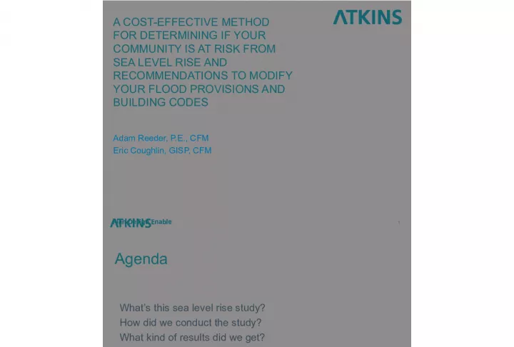
1. 1 A COST-EFFECTIVE METHOD FOR DETERMINING IF YOUR COMMUNITY IS AT RISK FROM SEA LEVEL RISE AND RECOMMENDATIONS TO MODIFY YOUR FLOOD PROVISIONS AND BUILDING CODES Adam Reeder, P.E., CFM Eric Coughlin, GISP, CFM
2. Agenda 2 Whats this sea level rise study? How did we conduct the study? What kind of results did we get? What do we tell the stakeholders? What are our conclusions?
3. Disclaimer! 3 The level of detail provided in this study is broad and uses existing data to gauge future risk Basically we arent making watches
4. Why conduct a sea level rise flood risk analysis? 4 Determine your communitys flood risk Convey that risk to your community Prove the need to reduce your risk through: more stringent local building codes more stringent local floodplain ordinances Confirm that you current codes and ordinances are practical
5. Who needs understand sea level rise and flood risk? 5 Its a game of politics: Home owners Government officials Developers and builders Realtors and appraisers Lenders Community
6. Sea level rise studies 6 Sea Le vel Ch an ge Tod ay 1- me ter 2- me ter 3- me ter 4- me ter 5- me ter 12- me ter Two basic types of sea level rise studies: 1. Permanent inundation study (fast forward time) Typically looking at the total number of flooded buildings or area 2. Incremental rise study (slow rise of water) Increase in risk as a $ value
7. Costs of a sea level rise study 7 Time (Labor) = Money How much time do you have? Six months or six weeks? Costs Breakdown Software Ground elevation data Flood study data Sea level rise projection research Analysis Report development
8. 8 Our Study A Small Scale Sea Level Rise Study The Analysis
9. Geographic areas analyzed 9 Atlantic Beach, North Carolina Wrightsville Beach, North Carolina Surfside Beach, South Carolina Isle of Palms, South Carolina These locations are very close to the areas studied in the NOAA Report Sea Level Variations for the United States 1855-1999
10. 10 Applications of sea level rise studies Sea level rise (feet) Year IPCC Rahmstorf Pfeffer 2010 0 0 0 2020 0.3 0.3 0.3 2030 0.4 0.5 0.5 2040 0.6 0.9 1.0 2050 0.7 1.2 1.5 2060 0.9 1.5 2.2 Courtesy: Weather Underground Studied 50 years into the future
11. Flood zone specific depth-damage functions applied 11
12. Analysis building sizes 12 Building Case Length (ft) Width Number of Stories Footprint Size (sq ft) Building Size (sq ft) 1 50 30 1 1,500 1,500 2 50 30 2 1,500 3,000 3 60 40 1 2,400 2,400 4 60 40 2 2,400 4,800 House Footprints and Square Footages Evaluated
13. Analysis foundation types 13 V Zone Wood Piles Concrete Piles Masonry Piers Coastal A Zone Wood Piles Concrete Piles Masonry Piers 8 inch Continuous Walls 12 inch Continuous Walls Slab on Fill A Zone Wood Piles Concrete Piles Masonry Piers 8 inch Continuous Walls 12 inch Continuous Walls Slab on Fill
14. Analysis inputs 14 Ground elevation (LiDAR) & Base Flood Elevations (BFE) used for each location Costs developed for houses constructed to BFE Location factors ($s) applied for each location
15. Analysis methods 15 Damages avoided between the four scenarios Four separate analyses were performed: Analysis 1: Baseline no sea level rise Analysis 2: IPCC Analysis 3: Rahmstorf Analysis 4: Pfeffer
16. Running the cost models 16 The entire model was developed in MS Excel Modified the FEMA Benefit Cost Analysis (BCA) 3.0 model Discount rate was adjusted to a modest 3.5% Used FIA depth-damage functions (V zone and A zone)
17. Calculating damages avoided 17 Chance of flooding adjusted based on building elevations Each model utilized five separate BCA runs to calculate incremental sea level rise and then summarize the benefits Compare baseline and rise models to determine increased risk Range (Percent Increase) Location: Atlantic Beach IPCC Rahmstorf Pfeffer V Zone 35-36 57-58 77-78 Coastal A Zone 35-36 56-58 75-77 A Zone 35-36 58-59 78-79 Comparison of increases in losses between the baseline and each model
18. Analysis questions 18 What is the risk at current BFE (increase in risk)? Response alternatives Current snapshot Do nothing Only add freeboard Fast-forward Additional foundation requirements (still unknown) Freeboard plus additional foundation requirements
19. 19 Our Study A Small S cale Sea Level Rise Study The Results
20. Findings V Zones 20 Location IPCC Rahmstorf Pfeffer Atlantic Beach, NC 35-36 57-58 77-78 Wrightsville Beach, NC 29-30 47-48 63-64 Surfside Beach, SC 72-73 75-76 75-76 Isle of Palms, SC 92-93 100-101 100-101 Percent Increase in Risk over 50 years
21. Findings Coastal A Zones 21 Location IPCC Rahmstorf Pfeffer Atlantic Beach, NC 35-36 56-58 75-77 Wrightsville Beach, NC 31-32 48-50 64-66 Surfside Beach, SC 18-19 28-29 36-37 Isle of Palms, SC 46-48 75-79 153-192 Percent Increase in Risk over 50 years
22. Findings A Zones 22 Location IPCC Rahmstorf Pfeffer Atlantic Beach, NC 35-36 58-59 78-79 Wrightsville Beach, NC 32-33 51-52 68-69 Surfside Beach, SC 18-19 28-29 35-36 Isle of Palms, SC 48-49 81-83 114-117 Percent Increase in Risk over 50 years
23. How do damages increase? 23 2010 2060 BFE - 2060 BFE - 2010 PERCENT DAMAGE FROM 1% ANNUAL CHANCE FLOOD
24. 24 Our Study A Small S cale Sea Level Rise Study The Conclusions
25. Communicating flood risk 25 Dont overwhelm the audience with data Large studies produce large data outputs Large studies confuse the public and can seem more abstract People are inherently self-interested These studies should become a catalyst for a wider discussion on flood risk Frame study results in language everyone can relate to
26. Why should the public care? 26 Local floodplain ordinances should consider impacts associated with sea-level rise. Higher freeboard adoption depends on a communitys decision to weigh the increased costs of construction versus the potential reduced risks. It is prudent for a community to address this risk as part of their entire hazard assessment. If we do see noticeable increase in risk over the next 50 years communities need to be proactive and make decisions to reduce their exposure.
27. Study accuracy concerns 27 Does it need to be more accurate? There are always unknowns with a flood study Future development is difficult to predict Communities are provided a general idea of the magnitude of their risk from sea level rise Manage the balancing act of more data is more accurate, but also takes more time to compile ($$$) Be honest about the accuracy of the study Remember We arent making watches!
28. Recommendations 28 Use existing data FIS and FIRMs LiDAR Existing sea level rise models Use current community building elevation requirements Use location adjusted cost data to develop building costs
29. Recommendations (cont.) 29 Use an existing piece of software We rewrote an existing spreadsheet (tweaked slightly for SLR) We used Visual Basic macros to enter the data sets in the spreadsheet Use graphs to evaluate the data and look for trends Try to parse the data down to simple numbers We used percent increase in annual damages (SLR vs. constant sea level)
30. Study costs 30 Software: Excel and free FEMA BCA software Model development: 60 hours Data collection and processing: 15 hours Purchasing FIRMs and FISs: ~$20 Analysis: 30 hours Report generation: 20 hours We did it for a few thousand dollars total and told the story we needed to without spending hundreds of thousands of dollars
31. Questions 31
32. NFIP Recommendations 32 FIRMs provide information on rise levels Officially recognize Coastal A Zones and require that houses within the zone meet V Zone requirements Additional premium benefits for freeboard above 3 feet in Coastal A Zones and A Zones Premium reductions should offset the cost of increased freeboard (3 feet plus) in 5 years or less
33. Building Code Recommendations 33 Increased loading requirements for Coastal A Zones and A Zones V Zone building requirements to reflect more frequent low- level flooding Open foundation requirements for
34. Homeowner Recommendations 34 Homeowners should consider building houses higher than the minimum required elevations. Compared to the increased sea-level rise risk, the increased cost of construction is low. Consideration should be given to elevating existing homes and possibly relocating them to a less flood-prone area
35. Homebuyer Recommendations 35 Evaluate the benefits of purchasing a house that is constructed higher than the minimum requirements
36. Lender Recommendations 36 Lenders should not only consider the risk associated with a flood zone, but also the risk associated with the elevation the house is being constructed to. Based on the flood insurance criteria such as the building replacement value a lender may be assuming more risk with a mortgage than previously thought.
37. Public Planning Recommendations 37 Local floodplain ordinances should consider impacts associated with sea-level rise Risk assessments and hazard mitigation plans should reflect the increased risk due to sea-level rise Communities should reflect the risk of sea level rise in their long-term plans and consider it when approving development in flood-prone areas Specific floodplain ordinances should be adopted to address future changes to flood zones and changes in elevation requirements (e.g., Coastal A Zones that become V Zones)
38. Public Planning Recommendations 38 RISK ASSESSMENT OVERVIEW | OCTOBER 2008