Spatial Data Mining: Definition, Applications, and Algorithms

This article discusses the definition and applications of spatial data mining, including geographic information systems, remote sensing, and biomedical applications. It also covers spatial mining algorithms for analyzing spatial data and structures.
- Uploaded on | 0 Views
-
 kaylah
About Spatial Data Mining: Definition, Applications, and Algorithms
PowerPoint presentation about 'Spatial Data Mining: Definition, Applications, and Algorithms'. This presentation describes the topic on This article discusses the definition and applications of spatial data mining, including geographic information systems, remote sensing, and biomedical applications. It also covers spatial mining algorithms for analyzing spatial data and structures.. The key topics included in this slideshow are Spatial data, spatial mining, geographic information systems, remote sensing, biomedical applications,. Download this presentation absolutely free.
Presentation Transcript
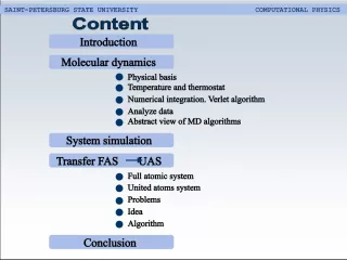
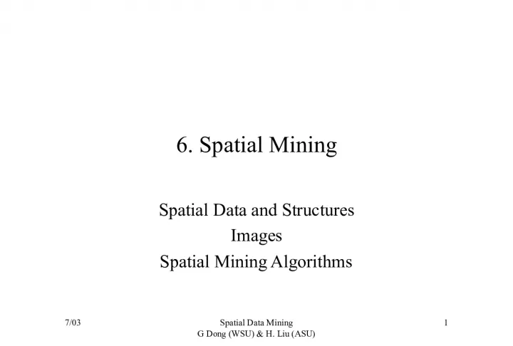
1. 7/03 Spatial Data Mining G Dong (WSU) & H. Liu (ASU) 1 6. Spatial Mining Spatial Data and Structures Images Spatial Mining Algorithms
2. 7/03 Spatial Data Mining G Dong (WSU) & H. Liu (ASU) 2 Definitions Spatial data is about instances located in a physical space Spatial data has location or geo-referenced features Some of these features are: Address, latitude/longitude (explicit) Location-based partitions in databases (implicit)
3. 7/03 Spatial Data Mining G Dong (WSU) & H. Liu (ASU) 3 Applications and Problems Geographic information systems (GIS) store information related to geographic locations on Earth Weather, community infrastructure needs, disaster management, and hazardous waste Homeland security issues such as prediction of unexpected events and planning of evacuation Remote sensing and image classification Biomedical applications include medical imaging and illness diagnosis
4. 7/03 Spatial Data Mining G Dong (WSU) & H. Liu (ASU) 4 Use of Spatial Data Map overlay merging disparate data Different views of the same area: (Level 1) streets, power lines, phone lines, sewer lines, (Level 2) actual elevations, building locations, and rivers Spatial selection find all houses near WSU Spatial join nearest for points, intersection for areas Other basic spatial operations Region/range query for objects intersecting a region Nearest neighbor query for objects closest to a given place Distance scan asking for objects within a certain radius
5. 7/03 Spatial Data Mining G Dong (WSU) & H. Liu (ASU) 5 Spatial Data Structures Minimum bounding rectangles (MBR) Different tree structures Quad tree R-Tree kd-Tree Image databases
6. 7/03 Spatial Data Mining G Dong (WSU) & H. Liu (ASU) 6 MBR Representing a spatial object by the smallest rectangle [(x1,y1), (x2,y2)] or rectangles (x1,y1) (x2,y2)
7. 7/03 Spatial Data Mining G Dong (WSU) & H. Liu (ASU) 7 Tree Structures Quad Tree: every four quadrants in one layer forms a parent quadrant in an upper layer An example
8. 7/03 Spatial Data Mining G Dong (WSU) & H. Liu (ASU) 8 R-Tree Indexing MBRs in a tree An R-tree of order m has at most m entries in one node An example (order of 3) R8 R1 R2 R3 R6 R5 R4 R7 R8 R7 R6 R3 R2 R1 R5 R4
9. 7/03 Spatial Data Mining G Dong (WSU) & H. Liu (ASU) 9 kd-Tree Indexing multi-dimensional data, one dimension for a level in a tree An example
10. 7/03 Spatial Data Mining G Dong (WSU) & H. Liu (ASU) 10 Common Tasks dealing with Spatial Data Data focusing Spatial queries Identifying interesting parts in spatial data Progress refinement can be applied in a tree structure Feature extraction Extracting important/relevant features for an application Classification or others Using training data to create classifiers Many mining algorithms can be used Classification, clustering, associations
11. 7/03 Spatial Data Mining G Dong (WSU) & H. Liu (ASU) 11 Spatial Mining Tasks Spatial classification Spatial clustering Spatial association rules
12. 7/03 Spatial Data Mining G Dong (WSU) & H. Liu (ASU) 12 Spatial Classification Use spatial information at different (coarse/fine) levels (different indexing trees) for data focusing Determine relevant spatial or non-spatial features Perform normal supervised learning algorithms e.g., Decision trees,
13. 7/03 Spatial Data Mining G Dong (WSU) & H. Liu (ASU) 13 Spatial Clustering Use tree structures to index spatial data DBSCAN: R-tree CLIQUE: Grid or Quad tree Clustering with spatial constraints (obstacles need to adjust notion of distance )
14. 7/03 Spatial Data Mining G Dong (WSU) & H. Liu (ASU) 14 Spatial Association Rules Spatial objects are of major interest, not transactions A B A, B can be either spatial or non-spatial (3 combinations) What is the fourth combination? Association rules can be found w.r.t. the 3 types
15. 7/03 Spatial Data Mining G Dong (WSU) & H. Liu (ASU) 15 Summary Spatial data can contain both spatial and non- spatial features. When spatial information becomes dominant interest, spatial data mining should be applied. Spatial data structures can facilitate spatial mining. Standard data mining algorithms can be modified for spatial data mining, with a substantial part of preprocessing to take into account of spatial information.
16. 7/03 Spatial Data Mining G Dong (WSU) & H. Liu (ASU) 16 Bibliography M. H. Dunham. Data Mining Introductory and Advanced Topics. Prentice Hall. 2003. R.O. Duda, P.E. Hart, D.G. Stork. Pattern Classification, 2 nd edition. Wiley-Interscience. J. Han and M. Kamber. Data Mining Concepts and Techniques. 2001. Morgan Kaufmann.